Porbandar Fm
Period:
Quaternary, Neogene
Age Interval:
Pliocene-Pleistocene
Province:
W.India Saurashtra Basin
Type Locality and Naming
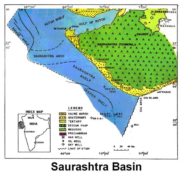
OUTCROP: Western coastal track of Saurashtra.
[Figure 1: Index Map of Saurashtra Basin (from dghindia.gov.in)]
Lithology and Thickness
Limestone. It consists of dirty to yellowish-white, bedded to massive, pelloidal limestone. Its thickness is 30 m in the type area.
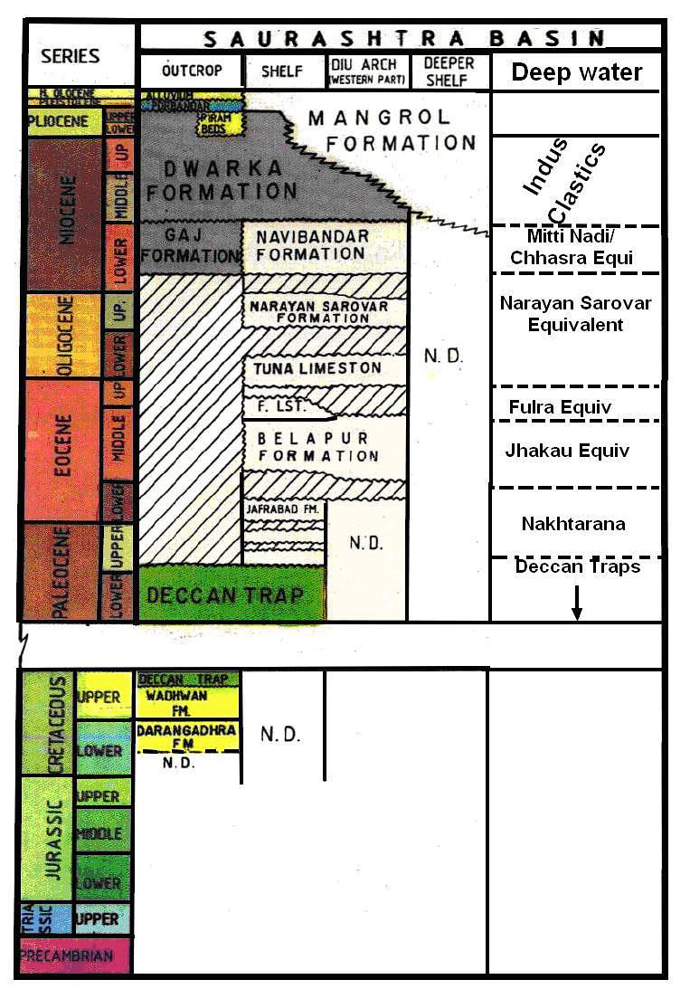
[Figure 2: Generalized Stratigraphy of Saurashtra Basin (from dghindia.gov.in)]
Lithology Pattern:
Limestone
Relationships and Distribution
Lower contact
Lower boundary is unconformable with the Dwaraka Fm, or locally on an intermediate Piram Bed Fm.
Upper contact
Upper boundary is unconformable with overlying Alluvium.
Regional extent
GeoJSON
{"type":"Feature","geometry":{"type":"MultiPolygon","coordinates":[[[[68.88,22.65],[69.65,22.91],[71.17,23.19],[72.03,23.27],[72.33,22.24],[72.18,21.97],[72,21.53],[71.39,21.26],[71.15,20.87],[70.59,20.85],[69.97,21.23],[69.55,21.48],[68.89,21.82],[68.88,22.65]]]]}}
Fossils
Abundant indeterminate forms.
Age
Pliocene - Quaternary.
Age Span:
Beginning stage:
Gelasian
Fraction up in beginning stage:
0.3
Beginning date (Ma):
2.35
Ending stage:
Chibanian
Fraction up in the ending stage:
1.0
Ending date (Ma):
0.13
Depositional setting
Under subaerial conditions to probably shallow-marine environment.
Depositional pattern:
Additional Information
Compiler:
D.S.N Raju

